
Walk a Bixby Street by Address
Search a Bixby street one parcel at a time. Begin with the situs address, which is the physical property location used on the assessment record. Then establish whether the parcel is in Tulsa County or Wagoner County. Bixby's corporate limits cross both counties, and the city label, ZIP Code, school district, or owner mailing address may point somewhere else. The result is a property trail, not proof of occupancy. It is still the soundest way to move from one address to the next without confusing similar street names or county systems.
- Locate the address in the Tulsa-side INCOG parcel service, or use Wagoner County GIS when the parcel routes east of the county line. Record the county, parcel ID, and legal description.
- For a Tulsa County parcel, search the Tulsa County Assessor by address, account, subdivision, or owner. Use the property card to compare the situs, owner, and mailing fields.
- Carry the parcel number and legal description to Tulsa Acclaim's parcel index, or use Wagoner's official property-record routing page for the Wagoner-side assessor, clerk, and treasurer systems.
- Read the instrument type, recording date, grantor, grantee, and legal description. A deed transfer may name an owner, but it does not establish that the owner lives on the street.
- For a dated household lead, consult library directories or voter records through their lawful official channels. Keep each source's date and purpose separate from the parcel record.
Note: A Bixby mailing address is a starting label, not a substitute for confirming the parcel's situs and county.
Bixby Street Records Cross Counties
Bixby is in the southern Tulsa metro area, but its incorporated limits extend through Tulsa County and Wagoner County. The Bixby Map Atlas, the ODOT city map, and the current-looking INCOG corporate-limit layer are useful orientation tools. They cannot replace the county property record. A block can be close to a city boundary, and a Bixby postal line does not select the proper assessor, clerk, court, or election office.
On the Tulsa side, INCOG supplies regional spatial context and parcel geometry. On the Wagoner side, the county's interactive GIS is a general-reference tool, with its page directing users to recorded plats and deeds for authoritative legal descriptions. Use the map to locate a parcel, then preserve the legal description from the assessor card or clerk instrument before making a street-by-street comparison.
Bixby Street Directory Assessor Fields
The Tulsa County Assessor search has one main field for an address, account, subdivision, or owner. Its help recommends using less text when a query fails and warns that periods, commas, and apostrophes can narrow a search too much. The search accepts address entries, subdivision names, owner names, and R-number accounts. Results also offer column-level filters, so an address search can be narrowed without changing the county route.
| Assessor Search Field | Input Type | Use in a Bixby Street Search | Format Notes |
|---|---|---|---|
| Address | Text with autocomplete | Find a situs parcel on a street | Help gives a form like 123 N Something St. |
| Account | Text | Return to a known property card | Accounts use an R-number pattern. |
| Subdivision | Text | Group lots within a recorded subdivision | Use the recorded subdivision name when available. |
| Owner | Text | Find parcels held under a name | Verify against parcel and legal-description fields. |
Use the sample Tulsa parcel card as a field guide for the Bixby street directory. It displays account and parcel identity, situs, owner mailing address, subdivision, lot and block or section information, building fields, values, and links toward clerk and treasurer data. The illustrated account is a sample field capture, not a Bixby household finding.
The official assessor parcel card shows why address labels need to be read separately.
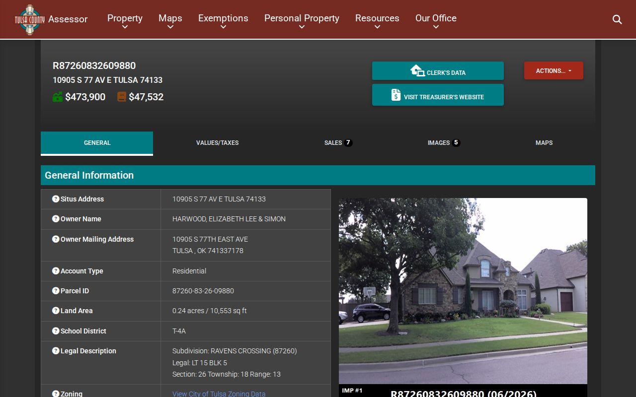
The card separates the situs from owner and mailing information, letting a reader retain the property record without treating any one address field as a current-resident finding.
Bixby Streets in the Parcel Map
INCOG mapping resources and the Tulsa County parcel service make it possible to view the geometry around a Bixby address. This is a locating step. Click or identify the central parcel, then note adjacent parcel IDs, street frontage, and subdivision context. Parcel lines are far more reliable than trying to infer a block from a mailing address alone. For Wagoner parcels, use the county's official GIS and follow its warning that maps are reference tools.
A map label is not the legal description. The parcel card and recorded instrument should provide the lot, block, subdivision, or section description that connects a visual parcel to the clerk's record. This distinction matters where a street crosses an area of later growth or a county boundary. It also keeps a street directory from overstating what a screen map can establish.
INCOG's Tulsa County parcel service is the official source behind this Bixby street-directory map view.
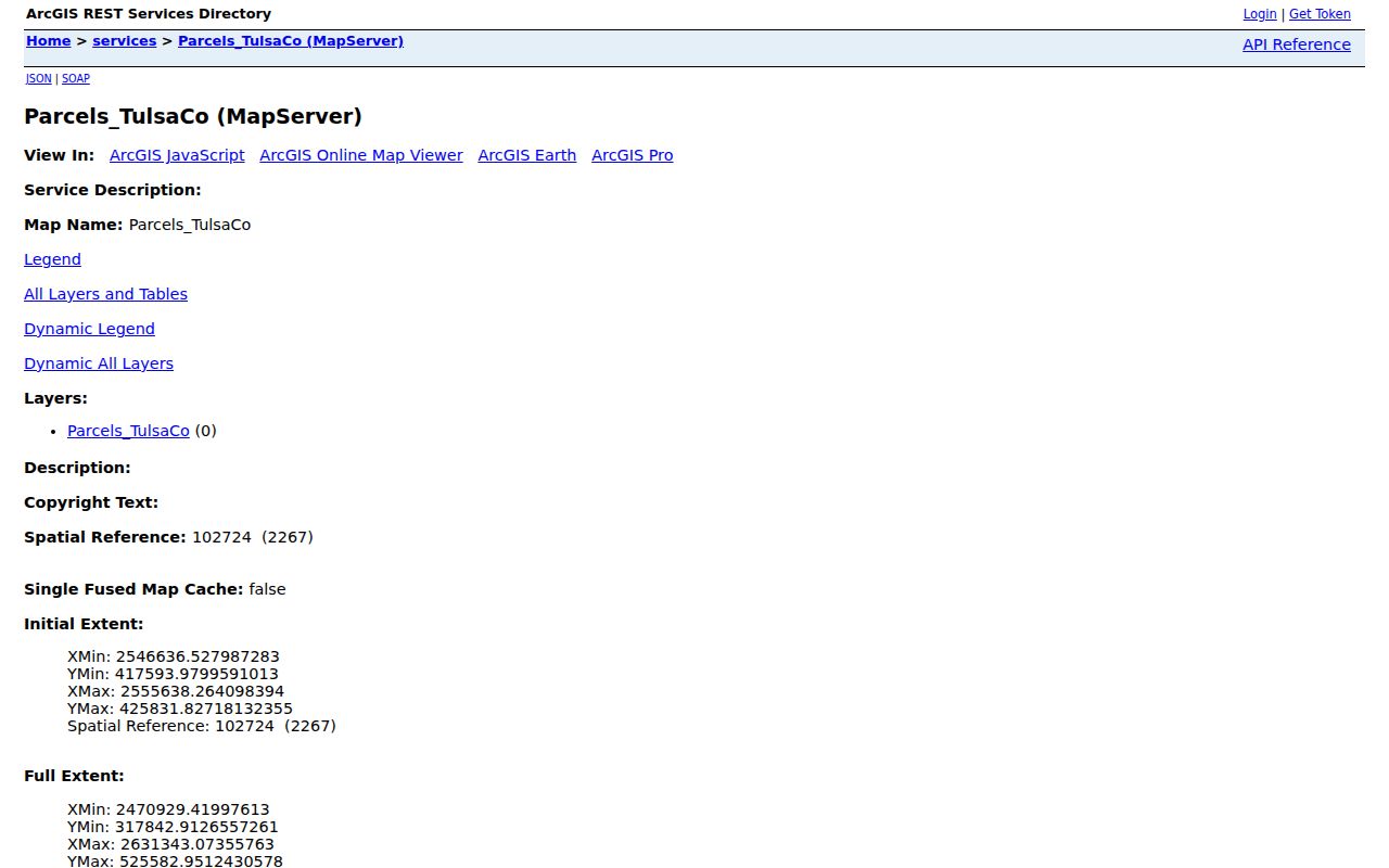
The parcel layer supplies a useful bridge from an address to parcel geometry, but a recorded plat or deed remains the source for a legal description.
Bixby Street Deeds by Parcel
For a Tulsa County parcel, Acclaim's parcel search accepts a parcel number with Starts With, Contains, or Exact choices. It also offers document-type and from/to-date controls, while deeper access has a registered-account and fee-based layer. County procurement material says the online name index reaches 1928 to current records and the legal-description index reaches 1987 to current records. Earlier material or missing images may require the clerk's historical route or a direct land-record inquiry.
Record the instrument number, type, filing date, grantor, grantee, legal description, and image status. A grantor conveys an interest; a grantee receives one. Neither term means current occupant. Move backward from the newest apparent conveyance, comparing legal descriptions at each step. Look for corrections, releases, probate material, survivorship language, or a sheriff's deed when the trail changes suddenly. A sheriff's deed is a different transfer event from a routine sale.
Tulsa Acclaim's name-index screen shows the alpha-index path, including AZ Volume and Last Name controls, before its login and paid workflow.
Use the name index after the parcel route is known, since a common name alone can lead to instruments for unrelated properties.
Bixby Street Plats Define the Block
A plat maps the original lot and block arrangement for a subdivision. It can show common areas, easements, reserve strips, drainage, and restrictions that an assessor summary may not spell out. For Tulsa-side property, identify the plat through the clerk's plat index or INCOG, then preserve its recording reference. For Wagoner property, the county's section-plats page says its maps are for location only and directs users back to the property card for ownership and assessment.
- Parcel
- A defined piece of land in the assessor and mapping systems, normally identified by a parcel ID.
- Situs address
- The property location used for the record, distinct from an owner mailing address.
- Plat
- A recorded map that sets out lots, blocks, easements, and other subdivision geometry.
- Criss-cross directory
- A historical reverse directory arranged by address, useful for a dated listing rather than current occupancy.
The Bixby Meadows plat attachment provides a local example of an owners association responsible for common areas. It is a lead to recorded declarations and amendments, not a public member list. For a full current-street record trail, keep the inquiry centered on plats, parcel IDs, and recorded instruments.
Bixby Address Records at City Hall
Bixby Development Services handles building permits, engineering and construction, planning, zoning, inspections, and INCOG referrals inside the incorporated city. A permit can be a dated activity lead for an address. It may identify the type of work, parcel or address, issue date, and public applicant or contractor fields, if released. It is not evidence that any person lived at the property.
No complete public searchable Bixby permit database or historic coverage range was located in official sources. For a narrow request, Bixby's Open Records request route accepts online, in-person, and mail submissions to the City Clerk. Give the parcel address, date range, department, and precise record type. The general city form rejects generic requests and lists $0.25 per page, $1 for certified copies, $5 for media, and $20 per hour for search work.
Code-enforcement complaints require similar care. Bixby Police Code Enforcement has a complaint process, but no official searchable case index was found. An intake record is not a sustained violation. A request should identify the address, known case number, date range, desired inspection material, and disposition.
Bixby Street Directory Record Sources
Each address-keyed source answers a different question. The assessor card is a property-and-value record. GIS helps locate parcels. County-clerk instruments document recorded transactions and plats. City files may show a requestable administrative event. Election records have separate legal access rules and are not a casual block roster. Reading these sources together is more accurate than flattening their fields into a single claim about who lives on a Bixby street.
| Address Record | Custodian | What It Can Establish | Access Route |
|---|---|---|---|
| Property card | Tulsa Assessor or Wagoner assessor | Parcel, situs, owner and mailing fields, legal and building data | Official county property system |
| Parcel map | INCOG or Wagoner GIS | Parcel geometry and adjacency for routing | Official reference viewer |
| Deed, lien, easement, or plat | Applicable county clerk | Recorded instrument, date, parties, and legal description | Index, image access, clerk inquiry, or copy request |
| Permit or inspection record | Bixby Development Services | Dated city activity if responsive records exist | City office or focused Open Records request |
| Voter registration record | Oklahoma Election Board | Registration information under the portal or EDW rules | Official portal or regulated request channel |
When the question changes from a long street to an individual record, use the Bixby resident lookup for source-specific verification rather than assuming a parcel result identifies every household member.
Bixby Street Address Fields Differ
Street searching often fails because different records use different address vocabulary. The assessor's situs is a property location. A mailing address can belong to an owner or tax recipient somewhere else. A legal description ties an instrument to land, even if road names change or an address is formatted differently. A voter address is an election record at a particular record point. A historical directory listing is a publication-year entry. Keep the source and date with every field.
The old Bixby City Map is marked as printed in 2008 with April 2008 parcel information. It can orient historical street or city-limit work, but it should not be treated as a current ownership or boundary record. Compare it with a current parcel source and the instrument's legal description before relying on an address match.
Bixby Street Deed-Fraud Check
Unexpected deed, mortgage, lien, or ownership-change notices warrant a check of the applicable official county land records. The Oklahoma Real Estate Commission's 2026 deed-fraud notice lists those events as warning signs and directs people to verify records through the recorder, report suspected fraud to law enforcement, and seek legal advice where needed.
On the Wagoner side, the County Clerk warns about a false letter seeking $86 for a deed copy and promotes its free Eagle Fraud Guard alert service. Its listed certified-copy fee is $2 per page. Obtain a copy through the clerk rather than responding to an unsolicited private mailer. The exact alert enrollment fields and effective coverage were not located during the official-page inspection.
Note: A land-record alert identifies a filing to review, not proof that a transfer is valid or fraudulent.
Bixby Street Directory Privacy Limits
A street directory cannot reliably identify all current occupants, a protected Address Confidentiality Program participant's physical location, or every member of a household. It also cannot supply private phone numbers, Social Security numbers, driver photographs, medical records, bank information, or a complete historic chain where online coverage begins after the relevant date. An owner, a grantee, a mailing recipient, and a resident are different roles.
Oklahoma's Address Confidentiality Program can provide a substitute post-office-box address for eligible participants, and state and local agencies must accept it in ordinary public-facing records. Do not try to reverse a substitute address. Driver records are separately regulated under the federal DPPA and state PII rules.
Lawful use. Bixby street and parcel records support personal research, historical work, civic questions, and record verification. They are not permission to follow, harass, intimidate, or expose a person, conduct prohibited by Oklahoma law.